Why Ho Chi Minh City Floods Every Rainy Season, and Why Its Famous Walking Street Was Once a Canal
Ho Chi Minh City sits barely above the sea. Heavy rain, twice-monthly spring tides, filled-in canals and sinking ground all push water into its streets.
[Why Ho Chi Minh City Floods Every Rainy Season, and Why Its Famous Walking Street Was Once a Canal]
Anyone who has lived in Ho Chi Minh City for a while has seen two kinds of flooding. In the rainy season, a downpour that lasts a little too long leaves downtown streets under water. Other times, there is no rain at all, yet roads near the river go under as the tide pushes water up from the river.
Both kinds of flooding come back to the lie of the land. According to Vietnam's Institute of Meteorology, Hydrology and Climate Change, international elevation datasets put the city's average ground level at roughly mean sea level, which means spring tides can rise above much of the urban surface. Many areas are protected by dikes and tide gates, and many roads sit above sea level. Still, city data from 2015 showed that four-tenths of the land within the old city limits, before the 2025 merger with Bình Dương and Bà Rịa–Vũng Tàu provinces, lay less than 1 meter above sea level. The original city slopes down from the north and northeast toward the south and southwest. Whether water drains away depends on how much rain falls, and on how high the tide is.
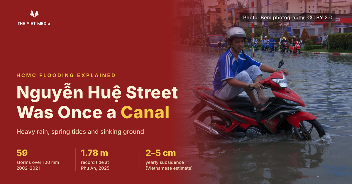
This low-lying city was once laced with waterways. Nguyễn Huệ, the downtown walking street, was a canal a little over a century ago: the Kinh Lớn, or Grand Canal. The Nguyễn dynasty dug it so boats could travel from the Saigon River to the Gia Định citadel, reaching the area where the city's People's Committee building stands today. A market grew up along its banks. After the French took Saigon, they complained the canal was filthy and foul-smelling, and filled it in around 1887 to build a boulevard. Nearby Lê Lợi and Hàm Nghi streets were also waterways once. Under French rule, Saigon's canals were both dug and filled. The French first cut channels to drain low land near the river, then filled in many canals to build roads. Downtown drainage moved underground into brick arched sewers. The oldest stretch, under Đồng Khởi Street, had been in use for about a century and a half by 2015.
As the city spread outward, lakes, channels and wetlands on its edges were also turned into building land. Hồ Long Phi, former director of the Center for Water Management and Climate Change at Vietnam National University–HCMC, argues that filling in waterways and paving over the ground left rainwater with nowhere to soak in and nowhere to be stored. Urban planner Ngô Viết Nam Sơn said in 2018 that the worst-flooded areas were those where lakes and canals had been filled in and building density had been allowed to rise sharply. In 2015, Nguyễn Bách Phúc described the marshes of former District 7 and Nhà Bè as the city's "lungs," the place where the whole city once drained, before they were filled in for housing. ("Former" refers to district names before the 2025 administrative reorganization.)
Ho Chi Minh City has only two seasons, dry and rainy. The rainy season runs from May to November and brings about 90% of the year's rainfall, with June and September usually the wettest months. Under the drainage plan approved in 2001, main canals are designed to carry away about 96 millimeters of rain over three hours. Secondary sewers are built to a lower standard. When rain falls harder than that, the water cannot drain fast enough.
Those storms are getting more common. A 2021 report by the city's Department of Construction counted only nine storms dropping more than 100 millimeters of rain between 1962 and 2001. In the roughly two decades from 2002 to 2021, there were 59.
Tides are the other half of the problem. The city's rivers rise and fall with the sea every day. The Southern Regional Hydro-Meteorological Center said in 2025 that daily tides usually peak between 5 and 7 a.m. or between 5 and 7 p.m., right at rush hour. Tides run highest around the start and middle of each lunar month. Over the year, spring tides above warning levels mostly arrive in the ninth to eleventh lunar months, and in December strong northeast winds push water levels even higher.
Tide levels are also rising. The Department of Construction found that between 1980 and 2007, no station recorded a tide above 1.5 meters. Higher readings began only after 2008. In November 2025, the Phú An station on the Saigon River recorded 1.78 meters, its highest on record. Once water tops the riverbanks and dikes, low-lying land along the river floods.
Flooding has different causes in different places, and in many neighborhoods rain and tide arrive together. In 2016, Dr. Bùi Thị Minh Hà of the University of Social Sciences and Humanities and the Southern Institute of Water Resources Research surveyed households in flood-prone areas. In former District 11, every household that flooded was hit by heavy rain alone. In former District 8, where low-lying ground sits only about 1 meter above sea level, nearly 80% of households flooded from rain and tide combined.
Lê Đình Quyết, head of forecasting at the southern hydro-meteorological center, explained in 2025 that flooding from high tides alone usually recedes quickly. When heavy rain or northeast winds hit at the same time, the water lingers. In late October 2025, the Saigon River spilled over its dikes and left the Thanh Đa peninsula and Bình Quới area under more than half a meter of water. On one of those days, heavy rain fell during high tide, and releases from the upstream Trị An and Dầu Tiếng reservoirs also coincided with the tide.
The ground itself keeps sinking, though estimates vary widely. A team led by Singapore's Nanyang Technological University used satellite radar to measure an average subsidence of about 1.6 centimeters a year across the city, and found it was sinking faster than sea levels are rising. Vietnamese researchers put the average at 2 to 5 centimeters a year, and 7 to 8 centimeters in areas with weak soil or dense commercial buildings. As the ground drops, even a slightly higher tide can flood low-lying areas.
The main cause is decades of excessive groundwater pumping. As water is drawn out of the aquifers, the soil above them settles. The city is built on young, soft river-mouth sediment that compresses easily, and the weight of buildings and traffic speeds up the sinking.
The city has had plans for all this. Drainage and tide-control plans approved in 2001 and 2008 called for thousands of kilometers of sewers and 103 regulating lakes, along with a ring of dikes and large tide gates. By 2025, only a little over 60% of the sewer network had been built, and the regulating lakes had barely been started. As early as 2015, experts warned that while flood spots in the center were shrinking, flooding was moving out to the city's edges.
In 2013, Dutch engineering firm Royal HaskoningDHV and research institute Deltares proposed a different approach. The official plan called for a 172-kilometer ring dike with 12 tide gates. The Dutch team suggested a smaller dike around the city center only, with designated flood zones on the outskirts where water could go. Their plan was also much cheaper.
What eventually got built at scale was a set of tide gates and dikes. The first phase, costing about VND10 trillion, includes six large tide gates and dikes along the Saigon River, with protection extending to the city center. The gates close at high tide to keep river water out and open to drain when the river falls below the water level inside. In the rainy season, the channels behind the gates can also hold water temporarily. Construction began in 2016 but stalled for years over legal hurdles and disputes over how the investor would be paid. As of September 2026, it was expected to be completed and handed over that November.
The gates can stop water rising from the river. Rain falling from the sky still needs somewhere to go behind them. Hồ Long Phi drew the line clearly in 2026. Tidal flooding has a fix, the tide gates, and that work is more than 90% done. Flooding from heavy local rain has fixes too, from regulating lakes and storage tunnels to pumping stations. But they have been rolled out unevenly, so when one area is protected, the water simply spreads to its neighbors.
In 2026, the city said it plans to revise its flood-control program to focus on expanding urban water space, with more regulating lakes and parks that can hold water. It is also considering a pilot underground retention basin on a football club's land near Thủ Đức market. That runs in the opposite direction from what happened more than a century ago, when canals like the one under Nguyễn Huệ were filled in to make way for boulevards.
The Viet Media Pro: at least four in-depth articles a month, access to every paid article, building into a knowledge base on Vietnam's policy, industries, companies, and people.